
01→
Video · Stills · DroneVideo & still photography
Project, brand and architectural films that translate a place into a clear story.

spatial stories / visual intelligence
Photography, video, drones, 360°, scanning and 3D models—for the people who build, design and make decisions about places.
We turn a site into something people can see, understand and make decisions from.
Skylens combines a creative eye, field experience and advanced capture technology to give every project a clear presence—from concept and construction to marketing and delivery.
We create the right view for marketing, planning, monitoring and telling the project’s story.
Project, brand and architectural films that translate a place into a clear story.
Photography, visualizations and interactive experiences that reveal what has not yet been built.
Photogrammetry, point clouds, models, orthophotos and DSMs for planning and control.
Consistent visual records for comparison, gap detection and clear progress updates.
High-rises, bridges, infrastructure and complex sites captured from the angle that tells the full story.
An organized asset library for marketing, sales, planning teams and stakeholders.
03SKYLENS VIEWER · PRODUCT
Capture, upload, revisit, compare and turn the project record into the next action.
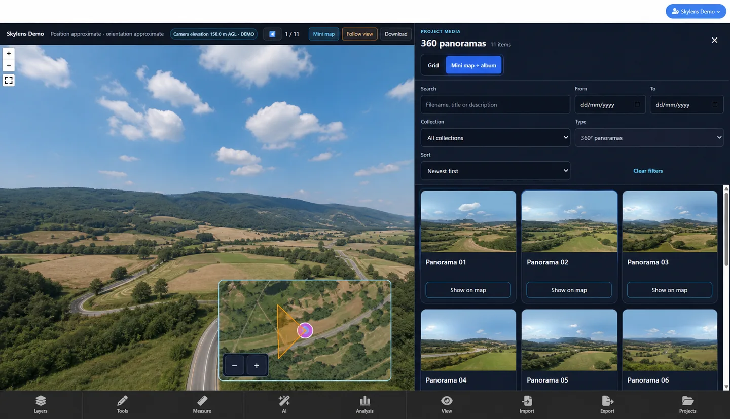
360° capture, dates, albums and 3D context live together so the team can return to the site without searching across disconnected files.
Real, anonymized Viewer screens. The live project opens only after your click.
Imagery, space and information work together to give a project presence.
Aerial and architectural documentation that places the towers in their urban context and clarifies their scale, façades and relationship to the surroundings.

Progress documentation that connects each capture date and presents the site as one clear, continuous process.
Deliverables change with the goal. The principle remains: turn complexity into clarity.
A focused, transparent process tailored to the project’s stage.
We identify what needs to be seen and who needs to see it.
We design a capture plan and deliverables around the site.
We photograph, scan and process to a consistent standard.
You receive an organized, ready-to-use asset library.
We work where photography, real estate and technology meet. Every project receives more than beautiful images: it gets a visual system that helps people understand the place—and act.
Tell us about your project. Your details are saved securely, and after submitting you can continue the conversation on WhatsApp.
Request received
We’ll get back to you after reviewing the project. You can continue on WhatsApp to add a message.
Yes. We can combine photography, video, 360° and 3D deliverables into one package built around the project goal.
We can start during planning, before construction, throughout execution or ahead of marketing.
Start with a few short questions, then continue on WhatsApp or schedule a call.