
Construction sites change every day. Walls close, services are concealed, ceilings are installed and concrete is poured. Once the next layer is complete, much of the physical information that was visible is no longer easy to inspect.
Capture is not the goal. The goal is a reliable, useful record before physical information disappears from view. The question is not simply whether someone photographed the site. It is whether the evidence can support what the project will need to understand, check or verify later.
The approach we propose at Skylens treats capture as a structured evidence process throughout a project. Instead of accumulating disconnected files, the aim is a trusted record linked to place, time, an element and a construction stage.
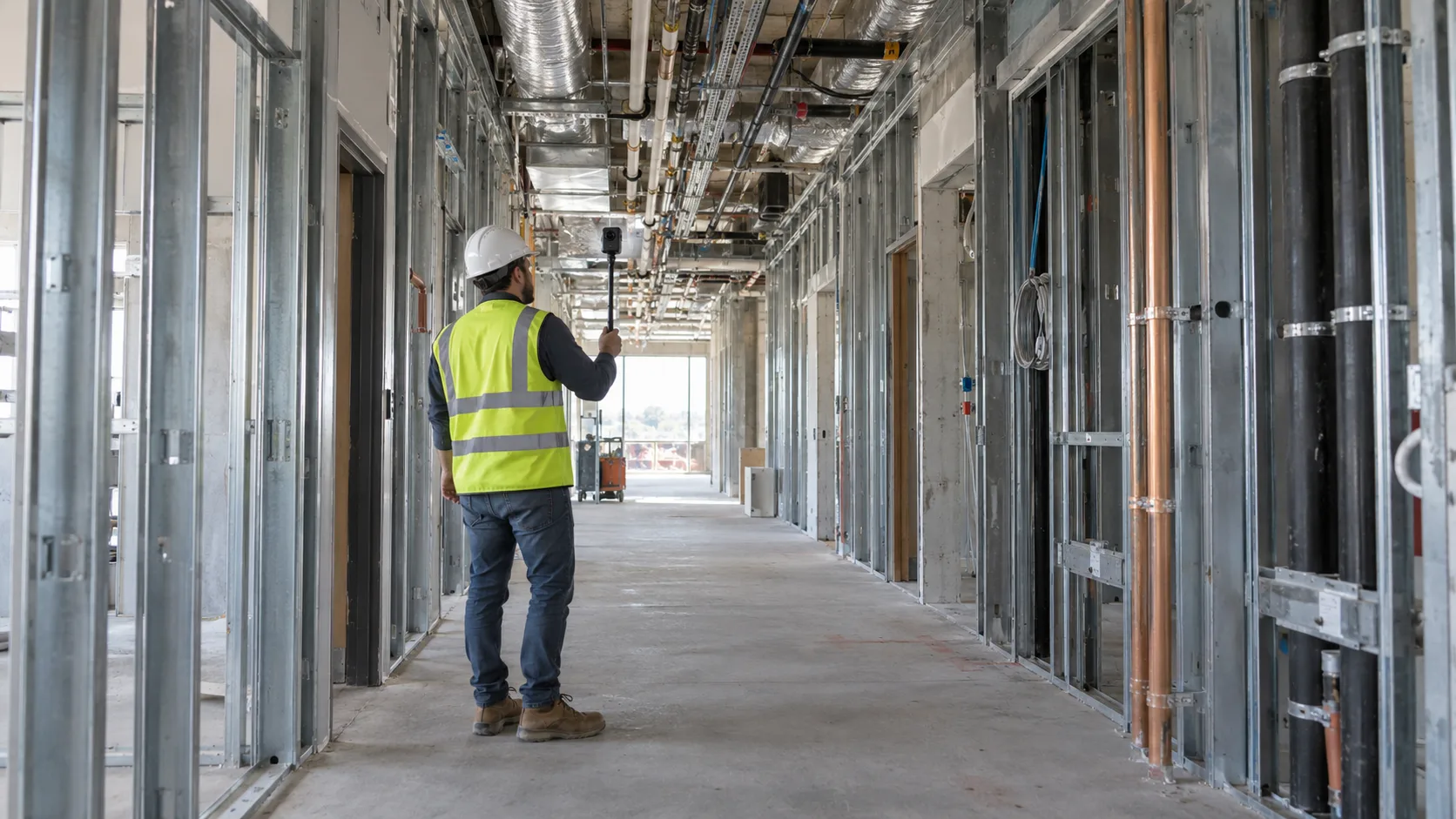
What does capture mean in construction?
Capture is the documented collection of a site's physical condition at a particular time. It can use 360° cameras, still photography, drones, LiDAR, 3D scanning, photogrammetry or controlled measurement.
The camera or scanner is a tool. Value comes from answering a defined question: where did the pipe run before the wall closed? Were the above-ceiling services documented? What preparations existed before the pour? Can a distance be measured to the required accuracy?
Here, evidence means a record supporting a specific question, with a source and context that can be checked. An image can document visible conditions; it does not by itself certify workmanship or positional accuracy.
Routine capture and event capture
Routine capture builds a continuous history
Periodic documentation helps teams understand what changed, where work progressed and how the same area looked over time. An initial plan might include a weekly 360° walk through active floors and a monthly drone capture of the envelope and surroundings. These are example frequencies to adapt to the project's pace and needs.
A consistent route helps comparisons. But a weekly visit can still miss a service installed and concealed between visits. That is why construction progress and 360° documentation also needs defined event triggers.
Event capture happens before information is concealed
Event capture is triggered by a critical construction stage, not just a calendar date. Coordinate the requirement with the site manager so there is time to review and complete the record before closure.
- Before wall closure: pipes, electrical and communications installations, insulation, reinforcement and penetrations inside the wall cavity.
- Before ceiling closure: HVAC, cable trays, sprinklers, drainage, supports and penetrations.
- Before concrete pours: openings, sleeves, conduits, anchors and embeds, as defined in the requirement.
- Before backfill and utility covering: routes, connections, chambers, valves and critical points.
- Before waterproofing is covered: the condition of the visible layer and details during installation. Visual documentation does not replace required waterproofing tests.
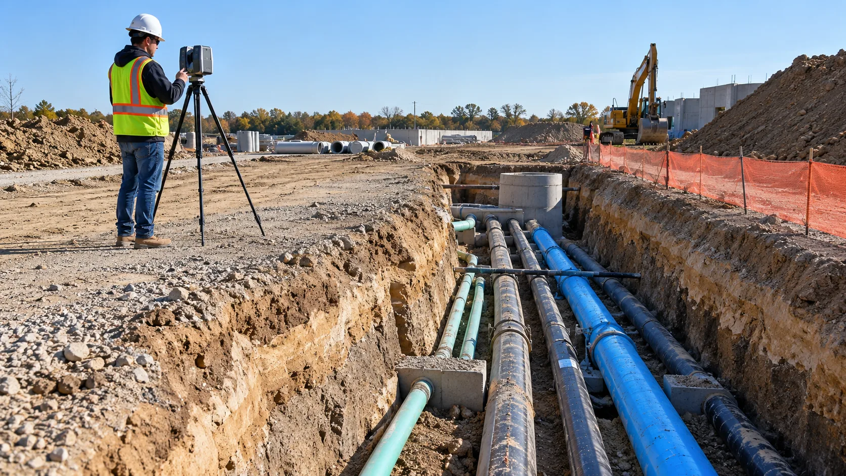
Different questions need different levels of accuracy
Not every event requires an engineering survey of the entire site. Match the method to the question. The following levels are a proposed Skylens planning framework, not a formal standard or certification.
Level A — Visual evidence
Photos, video and 360° captures document visible conditions—for example, that a pipe was installed when the image was taken. Their evidential value is limited by visibility, resolution and the ability to identify the element and its location.
Level B — Approximate metric
A reconstructed model or mobile scan may support spatial estimates. Record accuracy, coverage and alignment limitations; do not assume compliance with an engineering tolerance without suitable verification.
Level C — Engineering metric
For engineering measurement, define the tolerance, measurement method, calibration, check points and acceptable uncertainty in advance. LiDAR or a calibrated scanner can contribute, but the device type alone does not establish fitness for the requirement.
For background, see NIST on measurement uncertainty. Uncertainty describes the spread of values attributable to a measured quantity using the available information.
Level D — Survey authority
Where the project requires defined professional measurement authority and responsibility, include survey control, a reference system, verification and the appropriate professional. Record who approved the result, by which method and for what purpose.
The requirement and verification determine the level—not the file format or technology name. 3D mapping, scanning and spatial models provide different kinds of information that must be evaluated in this context.
Start with the evidence requirement
Instead of starting with “we need a 360° capture here,” start with “we need sufficient evidence of this service before it is concealed.” Visual capture may be enough to document a pipe's presence and approximate location. Verifying at least 80 mm of clearance around Pipe P-4827 also requires reference surfaces, measurement uncertainty and a decision rule.
The 80 mm threshold is an example, not a general requirement. A result near the limit cannot justify a pass when uncertainty could change the conclusion. If the existing capture cannot support a decision, keep the requirement open and request precision capture targeted at the question.
The proposed sequence is visual capture, evidence review, then more precise measurement where needed.
How do you know the capture is sufficient?
A successful upload does not mean a requirement has been met. Quality assurance should consider coverage, lighting, blur, occlusion, movement speed, continuity and overlap, planned-route compliance, location quality and suitability for the question.
Define coverage explicitly: required route segments, zones, surfaces or elements. A high percentage of a walking route does not necessarily document every concealed service. One missing critical point can prevent acceptance even when the overall percentage is high.
For illustration: a Level 08 MEP corridor has a coverage target of 95%, but review finds 84% coverage with Zones C3 and C7 missing. Request completion. These numbers are planning examples, not a formal threshold or a result from an actual project.
Give each capture requirement an owner and a deadline
An event requirement can record what to document, where, why, by when, what counts as sufficient coverage, the required measurement level, the operator and the reviewer.
An example before-ceiling-closure requirement:
- Location: Level 08, Zone C.
- Reason: document services before ceiling closure.
- Method: 360° capture with close-ups of specified points.
- Coverage: 95% of defined coverage units and every critical point.
- Level: visual evidence, without engineering measurement approval.
- Deadline: 24 hours before planned closure, as an example review window.
- Responsibility: a named operator and reviewer assigned by the project.
- Verification: human review and recorded gaps before marking the requirement complete.
The chain is requirement, capture, QA, observation, evidence and verification. Accepting the documentation and approving the engineering work are separate decisions with appropriate responsible people.
What happens when evidence is insufficient?
A missing area requires a revisit. Blur requires another capture. An element that cannot be identified confidently requires a targeted view or field identification. Insufficient measurement accuracy requires a suitable measurement process.
For example, a possible visual difference from BIM is a reason to investigate, not a verified engineering deviation. Check alignment, design revision and coverage first; then request precision capture if needed and obtain human verification. If the work has already closed and suitable evidence is unavailable, record an evidence gap rather than filling it with assumptions.
A repeatable route connects capture dates
An example route runs from the elevator lobby to the main corridor, apartments, MEP areas, the stairwell and back. Adapt it to safe access and the construction stage, and record any changes.
Consistency helps same-location comparison, coverage review and connections between dates. Reliable change detection also depends on positioning, visibility and comparable sources; a repeated route alone does not guarantee automatic alignment.
Combine 360°, drones and targeted measurement
- Periodic indoor 360° capture: a visual history of active areas.
- Drone capture on the project schedule: the envelope, roofs, earthworks and site surroundings. See drone photography for construction and infrastructure.
- Event capture: before closure, pouring or covering.
- Precision capture on demand: measurements or verification the existing sources cannot support.
No single tool satisfies every requirement. Value comes from connecting sources to a shared context, as discussed in our article on connecting 360° video, LiDAR and 3D models.
From a photo archive to a reviewable record
Link significant evidence to the project, building, floor, zone, element, time, source capture and observation. Retain the original, file identifier, capture time separately from upload time, operator, positioning method, QA results and review history.
This supports questions such as how a wall looked before closure, which image documented a service and what supports a measurement. Skylens Viewer provides the spatial context for connecting documentation; requirements, automated QA and escalation described here form a proposed operating model, not a claim that every mechanism is already active in the product.
A capture playbook: five workflows to start with
A playbook defines what to capture, when, why, at what coverage and accuracy, who approves it and how to address missing evidence. Start with five workflows:
- A weekly 360° walk, adjusted to construction pace.
- Monthly drone capture, adjusted to project needs.
- Capture before wall and ceiling closure.
- Capture before utility backfill and concrete pours.
- Precision verification on demand.
For each workflow define zones, triggers, responsibility, deadlines, methods, coverage units, QA criteria, reviewers, revisit rules and retention. Adapt the same framework to residential and office buildings, hospitals, data centers, industry and infrastructure.
Frequently asked questions
Is 360° capture enough before a wall closes?
It may satisfy a visual requirement if every required element is visible and identifiable. Hidden details, close-ups or measurements may need another method.
Does weekly documentation replace capture before a concrete pour?
No. If a critical stage occurs between visits, schedule event capture before it is concealed.
Does a LiDAR scan certify engineering accuracy?
Not on its own. The workflow, quality controls and verification must satisfy the project's defined tolerance and uncertainty requirements.
How can a team start without a complex system?
Choose one area and critical stage. Define the question, deadline, operator and reviewer, then link the original files to one requirement record. Expand after reviewing the process.
Capture while the information can still be checked
Value is not measured by image count or point-cloud size. It lies in returning to a documented condition, understanding what is visible and knowing what can and cannot be concluded.
The chain starts with a project requirement and continues through capture, QA and verification. Where a gap remains, collect targeted evidence while the information is still accessible. That is how a project builds a useful physical memory.
Talk to us about documenting your project's critical construction stages.